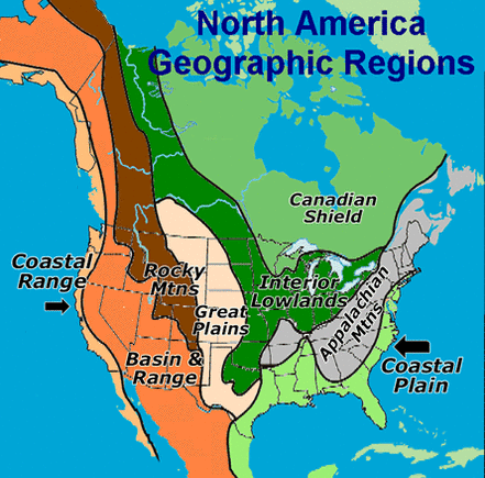
The map below displays the geographic regions of the U.S and Canada. These geographic regions are the Major-Sub geographic regions of the U.S and Canada culture region. The Canadian shield covers more of Canada then any other Major Sub-Region, and also has the greatest population compared to the rest. The Basin & Range, and the Interior Lowlands contain the most amount of land area, while also being the most populated.Over all, the Coastal Plains is the most heavily populated major sub-region of America and Canada.
- The coastal plain region is located along the Atlantic Ocean and the Gulf of Mexico. The broad lowland provides excellent harbors.
- The Appalachian Mountain region is located west of the Coastal Plain, and contains old eroded mountains. The Appalachian Mountain Range is the oldest mountain range in North America.
- The Canadian Shield region is wrapped around the Hudson Bay in a horseshoe shape, and contains hills worn by erosion, and lakes carved by glaciers.
- The Interior Lowlands is located west of the Appalachian Mountains, and contains rolling flat lands with many rivers.
- The Great Plains is located east of the Rocky Mountains, and contains mostly grasslands.
- The Rocky Mountains is located west of the Great Plains, and contains rugged mountains stretching from Alaska to Mexico.
- The Basin & Range region is located west of the Rocky Mountains. This region contains Death Valley, which is the lowest point, in elevation, in North America.
- The Coastal Range regions consists of rugged mountains, and fertile valleys along the Pacific Coast.
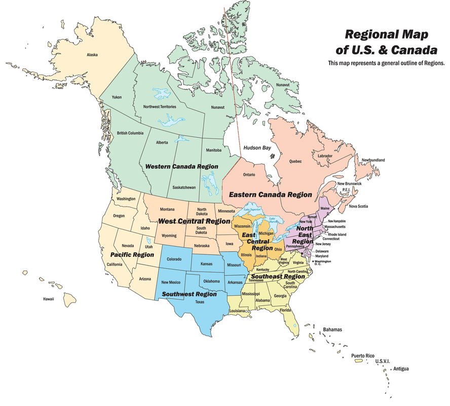
While the image above depicts the Major-Sub geographic regions of the United States and Canada culture region, the map below shows formal major-sub regions. The regions are divided by relative location, and function.